Globalization and Tourism: Signs of Wealth and Prosperity
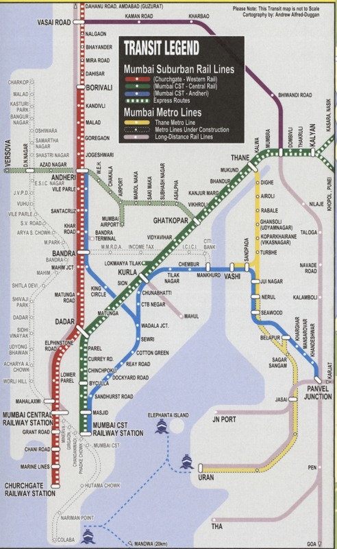
The first and foremost purpose of the ITMB Mumbai City Map is made quite clear through the name and publisher of the map itself. ITMB, which stands for International Travel Maps and Books, is a Canadian cartography company that specializes in creating easy-to-use maps of less frequented and less popular regions of the world for the international traveler (1). This emphasis on tourism in Mumbai is representative of increased globalization and prosperity in the city, and delving deeper into the details of the map itself will reveal the cartographer’s view of this bustling prosperity and development of Mumbai.
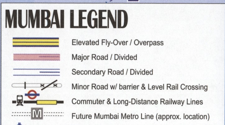
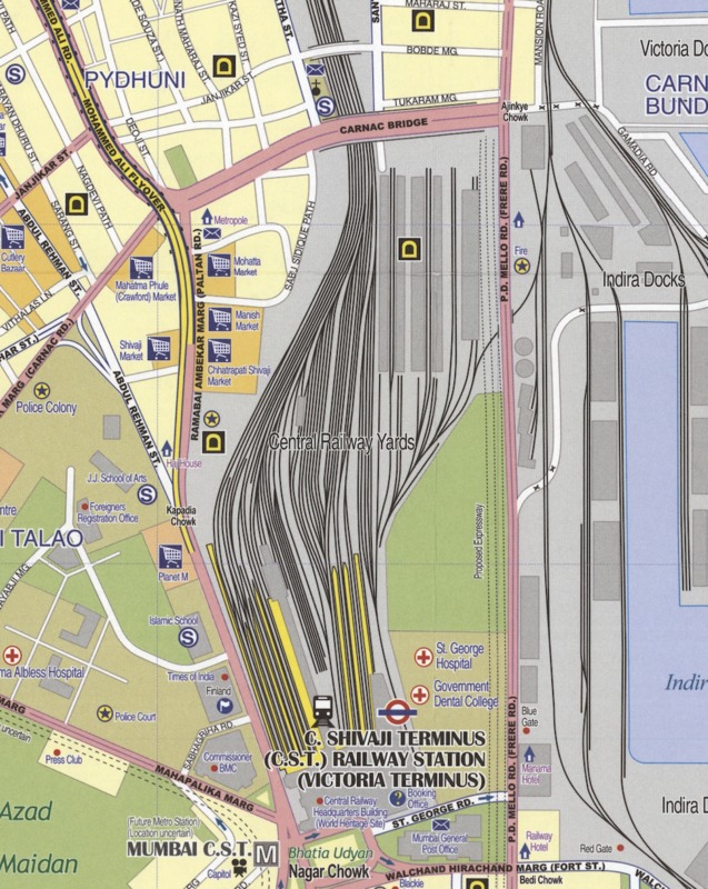
The map largely focuses on transportation within the portions of the city that is depicted, especially on car and rail transportation. As seen in the zoomed-in crops of the map to the left, the map features a section detailing the city’s suburban rail and metro lines, as well as extremely specific markings on its legend to depict different types of roads to be travelled by car or foot as well as various types of railway lines. This specificity in the legend and the cartographer’s deliberation in including a subway map places a large emphasis on both intra-city travel as well as travel between the city and its suburbs. This increase in prevalence of different modes of travel is quite indicative of increased urbanization, as ease of travel is one of the hallmarks of a growing city. What is most interesting about the legend is its inclusion of the “Future Mumbai Metro Line.” This inclusion of current construction further highlight’s Alfred-Duggan’s view of the city as a growing city- one with already-stable transportation infrastructure but also striving to improve and develop further. There is also a very large and prevalent section on the right side of the map as shown in the third figure that depicts the prominence of the C. Shivaji Terminus (C.S.T.) Railway Station along with its multitude of train lines along the neighboring Central Railway Yards. This rail station and its connecting lines are a an extremely salient portion of the map and further underscores the cartographer’s focus on tourism and travel in the city.
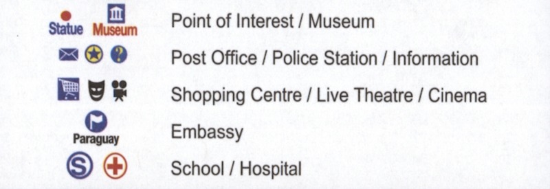
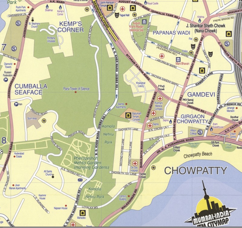
Secondly, as seen on the travel map, the legend also highlights “Points of Interest/Museums.” In addition, popular tourist destinations like cinemas and parks are easily depicted on the map through their respective icons, and the prevalence of cinemas and parks especially are obvious through a glancing overview of the map. The green areas of the park, as seen in the image to the right also starkly contrast the more yellow and beige background of the map to highlight an extremely accessible destination for travelers in Mumbai. Through all of these qualities of the map's content, the purpose of the map to serve the traveling tourist becomes clear and underscores the idea of Mumbai as a rising touristic metropolis.
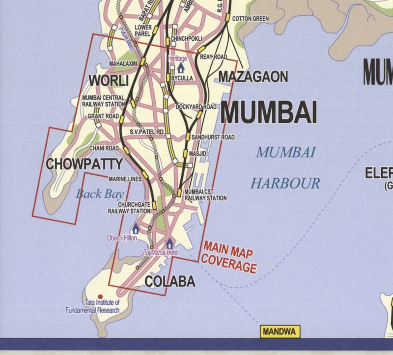
If one looks deeper into the map beyond its obvious legend and icons, a viewer can also note other aspects of the map that highlight the touristic and bustling aspects of depicted Mumbai. More specifically, this globalization and prosperity can be seen through analyzing what the cartographer has omitted from the map, especially in choosing the boundaries he wished to depict to a viewer. As Cosgrove wrote in his book Mappings, “All mapping involves a set of choices, omissions, uncertainties, and intentions,” (2) and Alfred-Duggan made many choices in choosing what to omit and include in the boundaries of his map. As seen in the figure to the left, which includes the coverage of the map in the context of greater Mumbai, it is clear that the cartographer only included a limited portion of the city in his map. More specifically, the portion to the south of the box includes a region of the city known as Navy Nagar, a self-contained region of the city that houses officers and staff of the Navy (3). Additionally, only authorized personnel are allowed to enter into the area, which provides a large barrier for tourism and travel. This deliberate omission of the southernmost tip of the city provides a sense of how the cartographer was primarily concerned with his audience of travelers and tourists and further presents portions of the city to be a bustling touristic and globalized urban area.
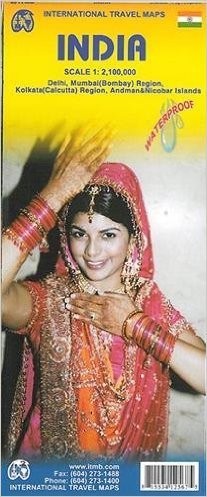
Lastly, it is interesting to look at this map in the context of other maps that the ITMB company has created. Another published map by the company depicts the whole country of India to provide a detailed road and travel map to tourists. However, the map of the country also includes insets of detailed overviews of specific Indian cities including Mumbai (4). This presents Mumbai as exactly what the ITMB Mumbai map emphasizes: a metropolis with a bustling and developing tourism economy and an urban culture that is not only essential to its own prosperity and globalization but also to the country of India’s prominence.
Works Cited
1. Joyce, Jack. "About Us." International Travel Maps and Books. ITMB, 2013. Web.
2. Cosgrove, Denis E. Mappings. London: Reaktion, 1999. Print.
3. Narayan, Rajan. The Lonely Cloud. Partridge India, 2015. Print.
4. ITM Canada. "India 1:2,100,000 Travel Map (International Travel Maps)." Amazon., 31 Dec. 2012. Web.