Not My Name, Not My Religion
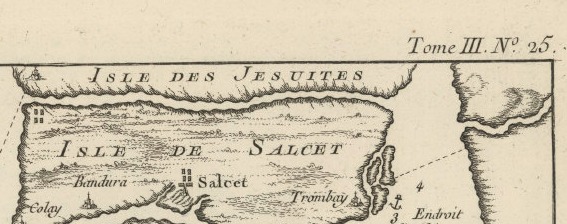
For Bellin, the map of Bombay and its surroundings was detailed and delibate. His purposes were to impose Christianity, impose the anglo name Bombay as opposed to Bombaim or any traditional Indian name prior to Portuguese and British rule, and lastly with resources labelled for export. To begin with, labelling the top region of the map's island as "Isle des Jesuites" or Island of the Jesuits is a clear imposition of Christinanity. Bombay and India as a whole is not only not a Jesuit country, it's not even a Christian one. In completely disregarding whatever name Indians traditionally had for the area, and putting a Christian naming in, Bellin is imposing the Euro-centric dominated religion on Bombay. That region is also at the top of the map, a place where people traditionally look first, meaning that Bellin wanted the viewer of the map to see the Christian influence before anything else. British rule certainly was not light on Christianity, as they sent missionaries and had missions all over India and Bombay to promote Christianity as opposed to Buddhism or Hinduism.
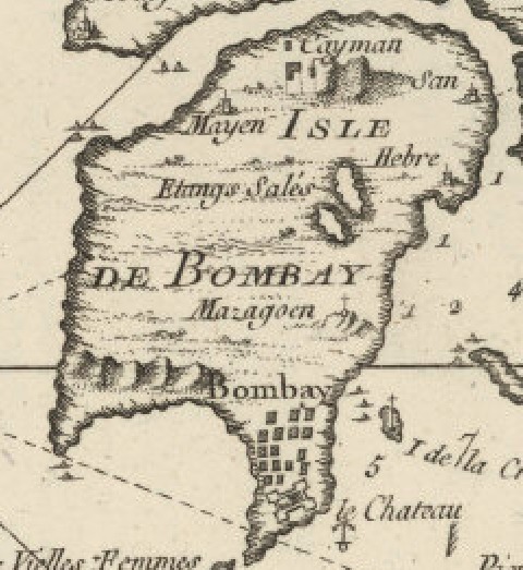
On top of the Jesuit name, naming the island and the entire map using Bombay is a clear imposition of European (specifically Anglo) ideology. In the years leading up to British rule and the British naming Bombay, Bombay, it was named Bombaim under the Portuguese. Of course, the Portuguse do not fall under the umbrella of "civilized" Europeans, as they are often paired with the Spaniards and cast aside from the French-English ally-enemy relationship. Not only did the French cartographer choose the British name instead of the Portuguese one, Bellin chose the English name in place of the traditional Indian one. This name choice on the map is Bellin enforcing Anglo-European influence and dominance over the Indian region. The Europeans name the area. Not Indians, even though it is their home.
The central part of the map, both titular and the largest island that Bellin created, is the "Isle de Bombay" or Island of Bombay. Bellin was purposeful in making this island the center because he named the map "Plans of Bombay and its Surroundings". Logically, this would be the primary focus. However, the centricity on Bombay itself goes beyond that. Bellin also uses symbols to label the island. Whether it's a cross to symbol a mission on a surrounding island, or a castle symbol to symbolize forts, or other symbols to symbolize other resources, Bellin makes sure that the map lays out for the French exactly what the island has to offer, so that they can exploit it.