East Feeding the West
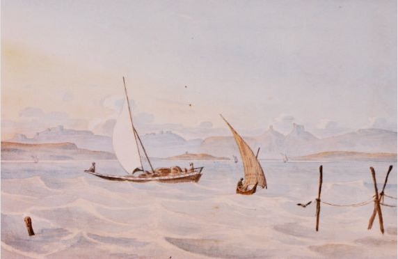
For Bombay under British rule in the 18th century, it became a resource hub for Britain and Europe alike. Raw materials were essentially exhausted in the West, and to continue with their societies and their needs, Europe needed to import goods from the East. in 1731-1732, when the George Lambert painting was made, Britain was ruled by King George II and was experiencing an era of incredible prosperity with the trading in India bringing in endless revenue and the colonies in North America generating tax funds and materials as well (Williams). Bombay was the focus of Britain in the east and they had their colonial holdings in the west. A similar theme that prevailed quickly between their holdings in the east and west was suppression of identity. Bombay was not allowed to develop an "Indian" identity that would be seen as an equal to the Euro-centric British one. Prominent paintings of Bombay were not those of Indian painters, but rather those of British painters who dominated the arts world (Williams), and in fact every world.
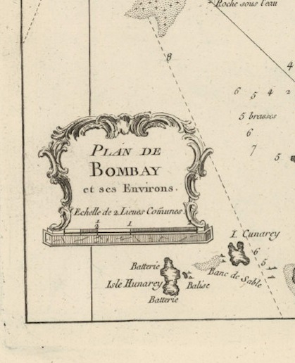
The British were not alone in needing India to export the raw materials they so desperately needed: France needed Bombay too. In 1764, when the Bellin map was commissioned, Louis XV was the ruler of France (Perkins). Jacques-Nicolas Bellin was commissioned to chart Bombay for the Ministère de la Marine of France. Bellin's maps however were for more than just compiling encyclopedias, it was to chart Bombay and India so that France could exploit as much of it as it could (Perkins). Louis XV had a monarchy in decline, and the French revolution would happen less than a two decades after his death.
"The French in India... accumulated fortunes by any means in their power" (Perkins 443).
Louis XV faced economic crisis in France, and for that reason, needed as much resources and wealth as possible from India. Bellin's map's title is that of "Plan of Bombay and its Surroundings" giving the French a martime style map to help them navigate in and out of the harbor, just like the ships in the Lambert painting. Also his decision to put the title not at the top or even center, but rather the bottom left corner is suggestive that Bombay and its regions, themselves are what are important to the map, specifically the resources that he labels on the map. The French, though not the ruling group in India, had residence in Bombay and continued to exploit the region with the same verocity that the British did.
Britain in 1764 however, was not doing that great. 1764 was the year of the Sugar Act (Williams) which not only discontented the American colonies and set off protests, setting the precedent for more discontent and later revolution, it signaled financial problems for Britain. In India itself, it was facing a challenge on the British East India Company by Nawab of Bengal Mir Qasim (Williams).
"...the resources for war in India had to derived from India itself" (Perkins 440).
Though the deposed ruler was defeated by the British East India Company, it took resources from India to do so. The challenge would not go unremembered, and the people and India itself were nearly exhausted by British control.
Perkins, James Breck. France under Louis XV. London: Smith, Elder, 1904. Print.
Williams, Hywel. Cassell's Chronology of World History: Dates, Events and Ideas That Made History. London: Weidenfeld & Nicolson, 2005. Print.